Participez au concours du Camping de l'année 2026! ICI.
Participez au concours du Camping de l'année 2026! ICI
Participez au concours du Camping de l'année 2026! ICI.
Participez au concours du Camping de l'année 2026! ICI


Imagine walking from the Mediterranean to the Cantabrian Sea with the Pyrenees as your backdrop. That is exactly what the GR 11 offers: one of the most spectacular long-distance trails in the Pyrenees and, without a doubt, the most mountainous route in Catalonia. If you are looking for an adventure that combines seascapes, centuries-old forests, peaks of almost 3,000 metres and villages with centuries of history, the GR 11 route is the journey for you.
The GR 11 route, also known as the Trans-Pyrenean Trail, runs along the southern side of the Pyrenees for hundreds of kilometres.
In Catalonia, the route covers around 380 km and crosses some of the most spectacular landscapes in the region:
It is a demanding route in some sections, but also a very flexible one: it can be done in stages, adapted or combined according to your level and the time you have available.
If you want to discover the GR 11 from its most iconic starting point, this section is one of the best gateways to the route.
The Girona section of the GR 11 Catalonia is the one that opens, or closes, depending on the direction, this great crossing. It starts at Cap de Creus and continues towards La Cerdanya. Here are the GR 11 stages in Catalonia with practical information.
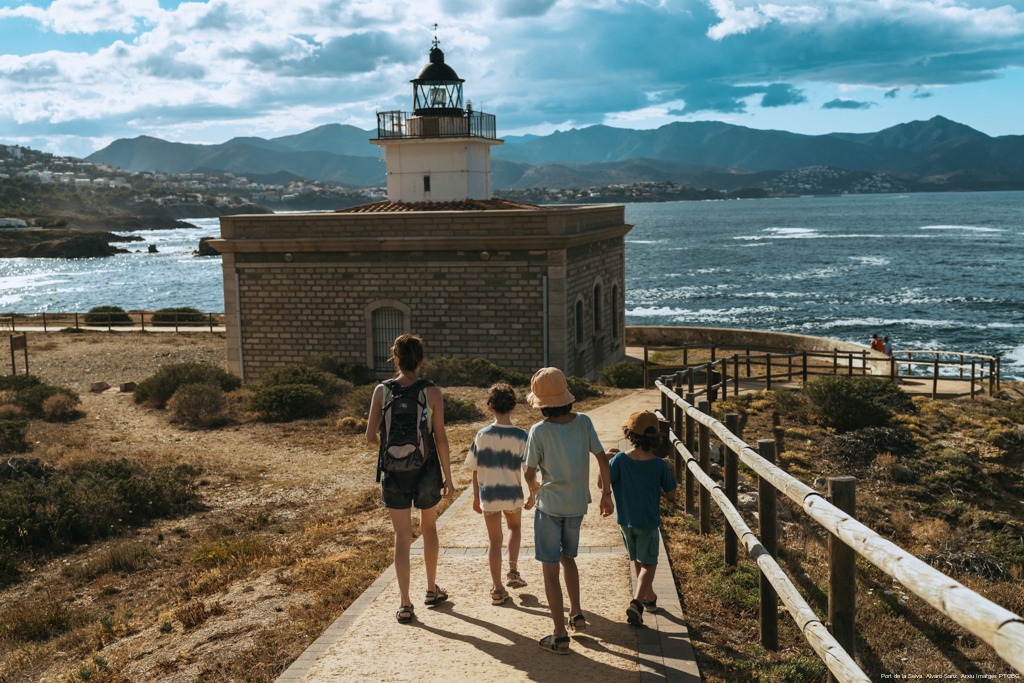
The first stage starts from the very tip of Cap de Creus, where the rock meets the Mediterranean. Following paths and tracks through the natural park, you will reach El Port de la Selva, a charming fishing village. An ideal start to get into the route.
A stage that masterfully combines sea and mountains. The main highlight is the monastery of Sant Pere de Rodes, a jewel of Catalan Romanesque architecture perched on top of a hill overlooking the Mediterranean. After descending to Llançà, you will say goodbye to the sea and head inland through the Empordà towards Vilamaniscle, among vineyards and olive groves.
The trail enters the natural area of the Albera mountain range, with its extensive cork oak forests. You will visit the monastery of Sant Quirze de Colera and the spectacular Requesens Castle. This is the most demanding stage of the first section.
The western Albera, with a strong historical component: thousands of people fled through this area during the exile of 1939.
To the Muga valley, passing through Maçanet de Cabrenys. The landscape changes into deciduous forests.
For the first time on the route, the trail climbs above 1,000 metres at the Bassegoda pass. The descent through the beech forests of the Alta Garrotxa to Sant Aniol d’Aguja is an experience many hikers describe as one of the most magical of the entire Trans-Pyrenean Trail.
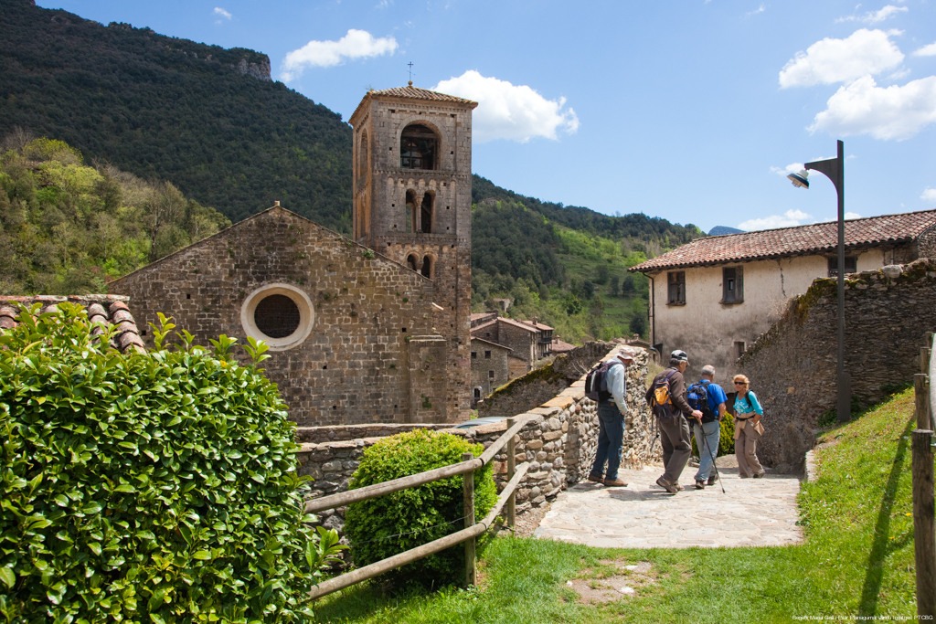
A full day through the Alta Garrotxa, with rugged, wild paths crossing ravines and mountain passes until reaching the beautiful village of Beget. Along the way, you will discover spots such as the spectacular Salt de la Núvia and the abandoned hamlet of Talaixà.
From Beget, the trail climbs to the Fembra Morta pass and the Lliens pass, with the silhouette of Rocabruna Castle accompanying you for much of the route. The stage ends in Setcases, at the headwaters of the River Ter, marking the entrance into the high Pyrenean mountains.
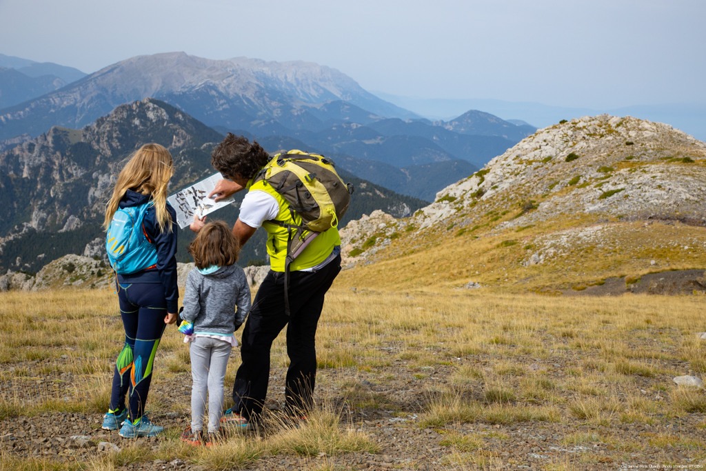
One of the most admired stages of the entire Trans-Pyrenean Trail. In a spectacular high-mountain setting, the section between Ulldeter and the Núria Sanctuary offers constant surprises: the Marrana pass, views of peaks rising above 2,800 m and the magical arrival at the sanctuary. A day to remember for a lifetime.
From Núria to Queralbs, the GR 11 follows the Camí Vell de Núria, a classic route in Catalan hiking. Afterwards, the trail continues through the Tosa river valley, passing the Font de l’Home Mort spring and the Coll de les Barraques pass before reaching Planoles.
This stage takes you to the great valley of La Cerdanya. From Planoles, you climb to the beautiful village of Dòrria and continue to the Creu de Meians pass.
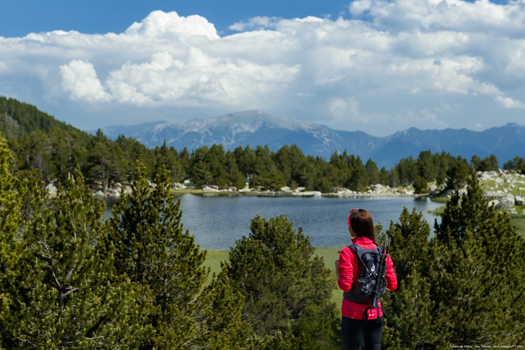
From the capital of La Cerdanya, this stage is almost entirely uphill to the Malniu Refuge, at 2,130 m above sea level, at the foot of the Puigpedrós massif. From there, it is highly recommended to visit Malniu Lake, one of the most iconic spots in the region.
Yes, some parts of the GR 11 by bike are feasible, especially the sections that follow forest tracks and wide paths. However, bear in mind that many stages include narrow trails, rocky terrain and high-mountain passes that are not suitable for cycling. If you are planning a mountain bike crossing, you will need to combine sections of the GR 11 with alternative routes and be prepared to carry your bike at certain points.
The best time to hike the Girona section of the GR 11 is generally from late June to September, and in some years also in early October, when the high mountains are usually more accessible.
The coastal and pre-coastal stages can be done almost all year round, although in summer you should carry enough water and be careful with the heat. In the high-mountain sections, always carry a map or GPS, warm clothing and waterproof gear. And, above all, enjoy every step: the Trans-Pyrenean Trail is not a race, but a journey through one of the most beautiful corners of the Pyrenees.
How long does it take to complete the full GR 11? Approximately 40 to 50 days. The Catalonia section can be completed in around 10-15 stages.
What level do you need to hike the GR 11? You need to be in good physical condition. Some sections are demanding, especially in the high mountains.
Can it be done in stages? Yes, this is the most common option. You can adapt the route according to your time and level.
Where can you sleep on the GR 11 in Girona? There are mountain refuges, rural accommodation and campsites. Campsites are a very practical option for resting and organising your stages.
What is the best time of year? From June to October for the high mountains. In the other areas, it can be done almost all year round.