Enter the 2026 Campsite of the Year contest! HERE.
Enter the 2026 Campsite of the Year contest! HERE
Enter the 2026 Campsite of the Year contest! HERE.
Enter the 2026 Campsite of the Year contest! HERE


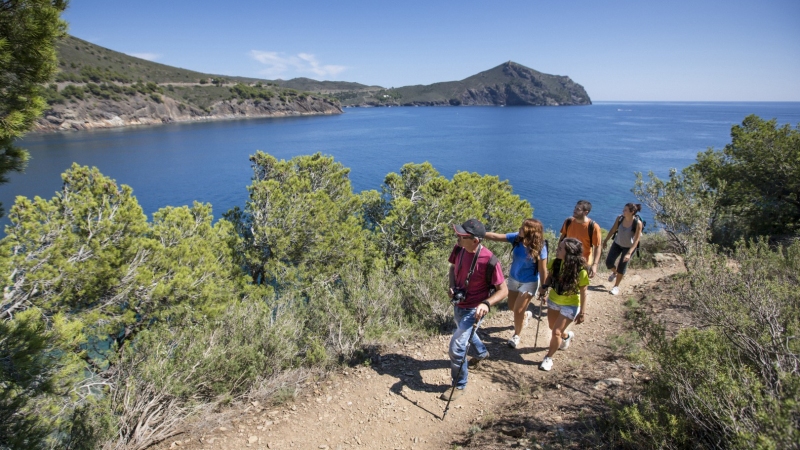
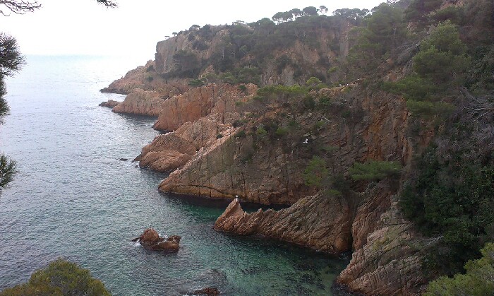
Do you like hiking near the sea? Then you must discover the most emblematic sections of the Camins de Ronda hiking trails along the Costa Brava, which will open your eyes to the scenic beauty of the region.
The Camins de Ronda are the name of the stages of the trails that trace over 130 kilometres of the GR-92 hiking route from Blanes to Portbou, bordering much of the Girona coast. For many, it is one of the best options for discovering the Costa Brava. These coastal trails, and their passage through seaside villages, give hikers a truly natural outing, Mediterranean landscapes, and the chance to learn the culture and traditions of some of the area’s most emblematic fishing villages.
The Camins de Ronda offer sections suitable for all levels of hikers. Whether you are an expert or prefer to take short family excursions, you will be able to find the ideal stretch for discovering the Costa Brava from within, walking through the pine forests and along steep cliffs, overlooking the deep blue sea at all times.
Now that you know the functions that these trails had, we at Càmpings de Girona want to help you get to know the most emblematic Camins de Ronda on the Costa Brava. That’s why we will describe each of the more noteworthy sections, starting in Portbou and ending in Blanes, indicating at all times the kilometres, the duration and difficulty of each route.
Let’s get started!
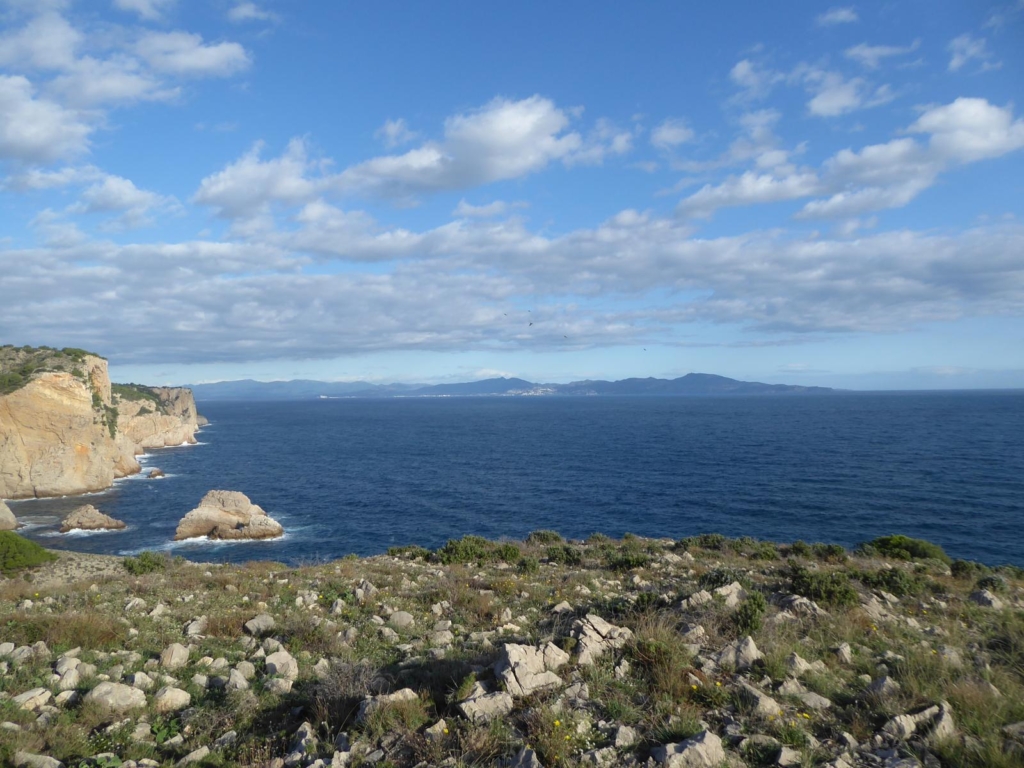
The first section can be started at Gran de Portbou beach. As this part of the coast is quite steep, the path heads inland towards Coll del Frare, a pass offering spectacular views of the sea and the cliff faces.
After walking the trails of this mountainous area, you begin to descend along paths that take you to the town of Colera. If it’s summer, we suggest you take advantage and take a swim on the village beach.
Time: 1 h 40 min
Distance: 4.33 km
Difficulty: Medium
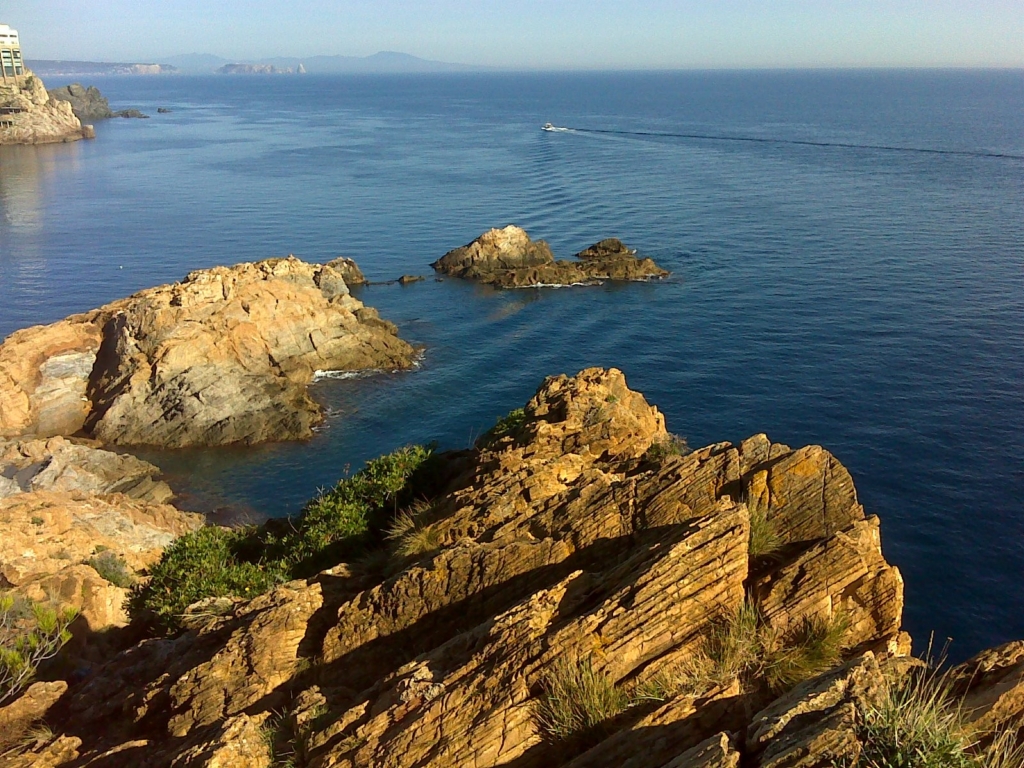
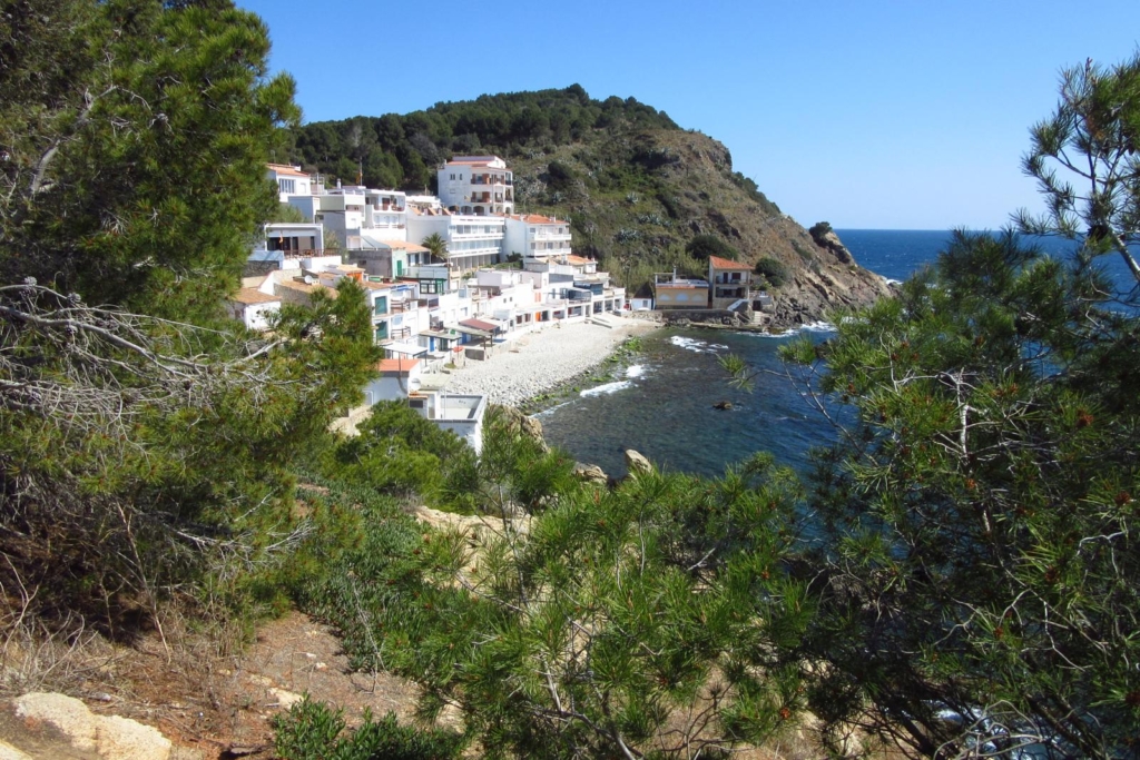
Following the Costa Brava to the south, we reach Cadaqués, one of the most charming villages on the Costa Brava, with its unique white houses and superb location in Cap de Creus.
From Cadaqués you can take the Camí de Ronda of Cadaqués, an easy excursion suitable for all levels of hikers. This path will give you panoramic views of the white houses of the village and will take you into the characteristic landscape to be found in the Cap de Creus Natural Park, until you reach the Cala Nans Lighthouse.
Time: 2 h 30 min (Round trip)
Distance: 7.2 km
Difficulty: Easy
Put yourself in the shoes of the constables who guarded this trail heavily travelled by smugglers and boats transporting illegal goods along the Girona coast. From the Roses Lighthouse to Almadrava Beach, you will be able to transport yourself to the past and imagine all the stories that must have taken place here.
This is an ideal trail to take as a family, for its gentle slope and being a relatively short outing.
Time: 2 h (round trip)
Distance: 6.24 km
Difficulty: Easy
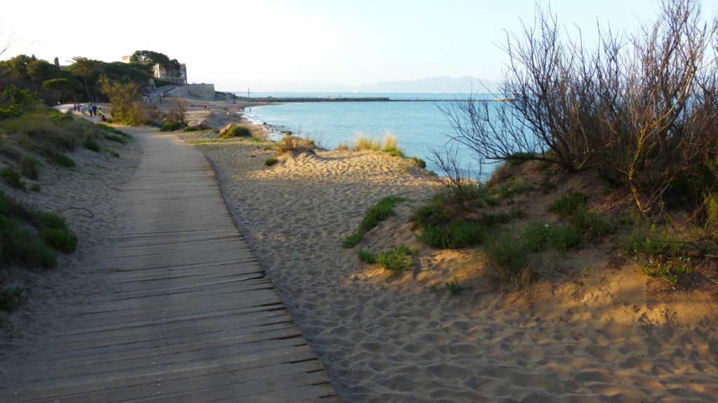
We continue south along the Costa Brava until we are in L’Escala, the point from where you can start several Camins de Ronda. In this case, we suggest you do the stretch that runs from the old town of L’Escala to Sant Martí d’Empúries.
This section makes for a very pleasant walk by the sea, ideal on foot or by bike, and adapted for those with reduced mobility. Along the way, you will pass by numerous beaches; the most outstanding is the Moll del Grec, in front of the Ruins of Empúries archaeological site.
La ruta finaliza en la bella villa de Sant Martí d’Empúries, donde podréis deteneros a comer y descubrir sus callejuelas empedradas, antes de volver a enfilar camino hacia L’Escala.
Time: 1 h 30 min (Round trip)
Distance: 5.2 km
Difficulty: Easy
This is probably one of the most spectacular stretches of trail on the Costa Brava, from Cap de la Barra (L’Estartit) to Cala Ferriol, where you will find a magnificent path that snakes among pine groves and along the cliffs, always with the Medes Islands in the background.
This stretch is intended for the most experienced hikers who can endure long distances and steep slopes. Along the way, you will find several unspoiled coves, where it is highly recommended to rest and take a nice dip to shake off the heat.
Time: 6 h approx. (Round trip)
Distance: 8.82 km
Difficulty: Easy
Begur and its surroundings is well known for the beauty of its beaches amidst the lush vegetation and forests. One of the most famous coves in the area is the Cala d’Aigua Blava. As its name suggests, it offers transparent and turquoise waters, in a superb setting.
So, we suggest you do this medium difficulty section between Cala d’Aigua Freda and Aiguablava. It doesn’t matter if you start from one point or the other; in both cases, you will be able to enjoy the well-deserved prize of a lovely excursion along the Camins de Ronda: a nice swim in either of these famed coves.
Time: 3 h 30 min (One way only)
Distance: 7.25 km
Difficulty: Medium
We continue our particular route along the most spectacular Camins de Ronda on the Costa Brava. We suggest you travel to Tamariu, in the beautiful Cala Pedrosa, which as its name suggests, is quite pebbly.
This thrilling walk along this path give you chance to see the little fishermen’s houses which are still standing. Before the spread of tourism in this region, there were only these small huts where fishermen kept their nets and repaired their boats.
Time: 1 h 30 min (Round trip)
Distance: 1.97 km
Difficulty: Medium

In Llafranc you will find another Camí de Ronda that you can’t miss! This section will take you to some of the most famous sites on the Costa Brava and will delight you with magnificent views from the Sant Sebastià Lighthouse, in Calella de Palafrugell.
This is an easy four-hour round-trip excursion, perfect to do with the little ones of the house and enjoy a fantastic family day on the Costa Brava.
Time: 4 h (round trip)
Distance: 6.83 km
Difficulty: Easy
A few kilometres further south is Palamós, another town that has a magnificent stretch of Camí de Ronda, such as the one that runs from Cala Margarida to Castell Beach.
All along this medium difficulty route, you will find small hamlets with traditional fishermen’s huts and idyllic coves where you can have a lovely swim.
Time: 4 h (round trip)
Distance: 8 km
Difficulty: Medium
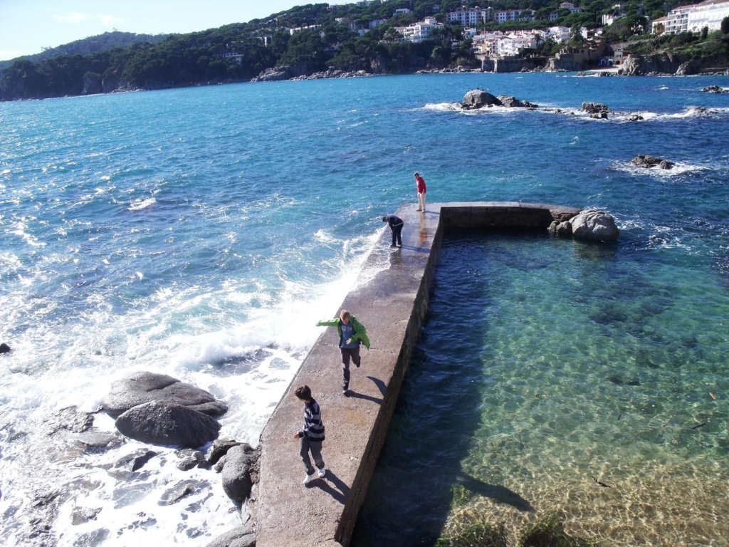
This is probably one of the most popular Camins de Ronda on the Costa Brava. This easy route with little difference in altitude and plenty of sea views offers pleasant walks on a path fullModernista-style houses and decorations.
Some of the highlights along this stretch are the tunnels carved into the rock and the roundabout by the sea. Get your camera ready, as you can’t help snapping pictures!
Time: 1 h 30 min (round trip)
Distance: 4.60 km
Difficulty: Easy
We move to Sant Feliu de Guíxols, to tell you about the penultimate section of the Camins de Ronda that we at Càmpings de Girona want to highlight. This is the Camí de Ronda that goes from Sant Pol Beach to Cala Jonca.
We recommend that you start walking from any point on Sant Pol Beach. In the first part of the path, you can see the one-of-a-kind houses along the promenade that date from the first arrival of tourists on the Costa Brava. You follow a well-groomed path, with short sections of stairs, surrounded by gardens bursting with flowers, until you reach the beautiful Cala Jonca, where you can take a dip and walk the path backwards.
An ideal excursion to enjoy as a family!
Time: 2 h 30 min (round trip)
Distance: 5 km
Difficulty: Easy
Finally, if you are an experienced hiker looking for a longer stretch, we suggest Section 12, which includes several paths that connect the towns of Tossa de Mar and Lloret de Mar.
You will be able to walk along a long and varied route, with sections through residential developments and other sections with beaches, rockier areas, pine forests, and much more. We recommend that you study up on the path before leaving, as not all sections are well marked.
We only recommend doing this walk if you are in good physical condition and have the necessary equipment for a seven-hour walk.
Time: 7 h (One way)
Distance: 12.17 km
Difficulty: Hard
The Camins de Ronda are paths full of history whose function has changed over time and today are used for leisure activities and enjoying nature.
According to historical records, the first roads were built out of the need to connect seaside villages and the beaches and coves of the coast, in addition to offering an emergency route for fishermen and sailors who ran aground on the rocky coast.
Later, these paths began to be transited by smugglers who profited by the trafficking of scarce commodities. Precisely, the name Camins de Ronda, comes from the constables and the civil guard who did their “rondas” or rounds to control the illegal activities that took place on these little-travelled roads set apart from the villages. Between 1940 and 1958, Spain suffered from the commercial isolation of international markets after the Civil War, which made it difficult to attain many products that were rationed or banned, such as coffee, sugar, pepper, chocolate, medicines, lingerie, make-up, jewellery, silk clothes, and many more.
To do a Camí de Ronda you only need the yearning to walk and discover the nature and sea of the Costa Brava. However, we recommend that before going out, consider the weather forecast and avoid the hottest times of the day.
We recommend bringing:
Want to do them all? As you may have already noticed, the Camins de Ronda are the best way to get to know and experience the Costa Brava. For this reason, if you have planned to cross the Girona coast from North to South, or a good part of it, we recommend spending the night at the campsites of Girona.
Many Girona campsites are close to the Camins de Ronda, which help hikers on their way to rest up and enjoy the comfort of the campsites after a hard day’s walk.
In addition, they are knowledgeable about the area and can recommend points of interest to visit along your route.
Now that you know the most remarkable Camins de Ronda, you can put on your shoes and start discovering the wonderful Girona coastline.
If you want to find out about more sections, you can always ask for information at the tourist office in the town where you want to start. Or, you can check out related articles like “The unmissable Camí de Ronda“